GEN 3.2 AERONAUTICAL CHARTS
GEN 3.2.1 RESPONSIBLE SERVICE(S)
The Aeronautical Information Service produces and publishes the aeronautical charts. For address, see subsection GEN 3.2.3 below.
The charts are produced according to the provisions in the following ICAO documents – Annex 4 Aeronautical Charts.
Differences to Annex 4 provisions are detailed in section GEN 1.7.
GEN 3.2.2 MAINTENANCE OF CHARTS
The aeronautical charts included in the AIP are kept up to date by amendments to the AIP. Corrections to aeronautical charts not contained in the AIP are promulgated by AIP Amendments and are listed under subsection GEN 3.2.8 of this section. Information concerning the planning or issuing of new maps and charts is announced by Aeronautical Information Circular.
Incorrect information detected in published charts is corrected by NOTAM if it is of operational significance.
GEN 3.2.3 PURCHASE ARRANGEMENTS
The charts listed under subsection GEN 3.2.5 of this section may be obtained from:
| ORO NAVIGACIJA AB | |
| AERONAUTICAL INFORMATION SERVICE DIVISION | |
| LT-02184 VILNIUS, LITHUANIA | |
| Tel.: | +370 706 94 613 |
| Email: | [email protected] |
| URL: | www.ans.lt |
GEN 3.2.4 AERONAUTICAL CHARTS SERIES AVAILABLE
- VFR Aeronautical Chart – ICAO 1:500 000;
- Aerodrome Chart – ICAO;
- Aircraft Parking/Docking Chart – ICAO;
- Aerodrome Ground Movement Chart – ICAO;
- Aerodrome Obstacle Chart – ICAO – Type A (for each runway);
- En-route Chart – Free Route Airspace;
- Area Chart – ICAO;
- Standard Departure Chart – Instrument (SID) – ICAO;
- Standard Arrival Chart – Instrument (STAR) – ICAO;
- Instrument Approach Chart – ICAO (for each runway and procedure type);
- Visual Approach Chart – ICAO;
- Precision Approach Terrain Chart – ICAO;
- ATC Surveillance Minimum Altitude Chart – ICAO.
- VFR Aeronautical Chart – ICAO 1:500 000
This chart is constructed on Lambert Conformal Conic Projection. The aeronautical data shown are consistent with the use of short and medium range operations and depict all relevant features. The chart includes a selection of aerodromes, significant obstacles, elements of ATS system, special activities areas, radio navigation aids and etc. The chart provides the information to satisfy visual air navigation and is also used as a pre-flight planning chart. - Aerodrome Chart – ICAO
This chart contains detailed Aerodrome data to provide flight crews with information to facilitate ground movement of aircraft:- from the aircraft stand to the runway; and
- from the runway to the aircraft stand. It also provides essential operational information on the aerodrome.
- Aerodrome Ground Movement Chart – ICAO
This chart is produced for those aerodromes where, detailed information necessary for the ground movement of aircraft along the taxiways to and from the aircraft stands cannot be shown with sufficient clarity on the Aerodrome Chart – ICAO.
This supplementary chart provides flight crews with detailed information facilitating both ground movement of aircraft to and from the aircraft stands, and the parking/docking of aircraft.
The chart is produced in combination with the Aircraft Parking/Docking Chart – ICAO for Kaunas, Palanga and Šiauliai. - Aircraft Parking/Docking Chart – ICAO
This chart is produced for those aerodromes where, due to complexity of the terminal facilities, the information cannot be shown with sufficient clarity on the Aerodrome Chart – ICAO or on the Aerodrome Ground Movement Chart – ICAO.
This supplementary chart provides flight crews with detailed information to facilitate both ground movement of aircraft between the taxiways and the aircraft stands, and the parking/docking of aircraft.
The chart is produced in combination with the Aerodrome Ground Movement Chart – ICAO for Kaunas, Palanga and Šiauliai. - Aerodrome Obstacle Chart – ICAO, Type A (Operating Limitations)
This chart contains detailed information of obstacles in the take-off flight path areas of aerodromes. In the plan it is shown from above and a profile view. - En-route Chart – Free Route Airspace
This En-route – free route airspace chart is produced for the Vilnius FIR/UIR. The chart provides flight crews with information facilitating navigation along FRA significant points, in compliance with air traffic services procedures. - Area Chart – ICAO
This chart is produced to show position-reporting requirements. It shows, in greater detail, the all aerodromes, prohibited, restricted and danger areas, and the air traffic service system. - Standard Departure Chart – Instrument (SID) – ICAO
This chart provides flight crew with information to enable them to comply with designated standard instrument departure route from the take-off to the en-route phase of flight. Each chart includes the relevant aeronautical information such as radio navigation facilities, significant points, bearings, distances, MSA and AMA. - Standard Arrival Chart – Instrument (STAR) – ICAO
This chart provides flight crew with information to enable them to comply with designated standard instrument arrival route from en-route phase to the approach phase of flight. Each chart includes the relevant aeronautical information such as radio navigation facilities, significant points, bearings, distances, MSA and AMA. - Instrument Approach Chart – ICAO
This chart are produced for all aerodromes used by civil aviation where instrument approach procedures have been established.
A separate Instrument Approach Chart – ICAO has been provided for each approach procedure. The aeronautical data shown include information on aerodromes, prohibited, restricted and dangerous areas, radio communication facilities and navigation aids, minimum sector altitudes, the procedure track displayed in plan from above and a profile view, aerodrome operating minima specifications, etc.
This chart also provides flight crews with information enabling them to perform an approved instrument-approach landing to the intended runway, including the missed-approach procedure and where applicable, associated holding patterns. - Visual Approach Chart – ICAO
This chart is produced for aerodromes used for VFR flights. - Precision Approach Terrain Chart – ICAO
This chart provides detailed terrain profile information within a defined portion of the final approach so as to enable aircraft operating agencies to assess the effect of the terrain on decision height determination by the use of radio altimeters. This chart produced for Kaunas RWY 26 and Vilnius RWY 01 aerodromes. - ATC Surveillance Minimum Altitude Chart – ICAO
This supplementary chart shall provide information that will enable flight crews to monitor and cross-check altitudes assigned by a controller using an ATS surveillance system.
GEN 3.2.5 LIST OF AERONAUTICAL CHARTS AVAILABLE
| 1 | 2 | 3 | 4 | 5 |
|---|---|---|---|---|
| 1:1 200 000 | Area Chart - ICAO (GND - FL095) | 19 FEB 2026 | ||
| 1:1 200 000 | ENRC - Free Route Airspace (FL 095 - FL 660) | 19 FEB 2026 | ||
| 1:1 600 000 | Index to Areas for Weather Services - Index Chart | 19 FEB 2026 | ||
| 1:6 000 000 | Area of Radars Coverage - Index Chart | 25 DEC 2025 | ||
| 1:1 600 000 | Prohibited Restricted and Danger Areas - Index Chart | 25 DEC 2025 | ||
| 1:1 600 000 | Restricted Areas for National Security Operations (GND - FL 660) - Index Chart | 19 FEB 2026 | ||
| 1:1 600 000 | Military Exercise and Training Areas and Air Defence Identification Zone (ADIZ) - Index Chart | 30 OCT 2025 | ||
| 1:1 600 000 | Airspace to be Avoided when Conducting Low Level Flights (500 FT AGL- 2000 FT AGL) - Index Chart | 19 FEB 2026 | ||
| 1:1 600 000 | Aerial Sporting and Recreational Activities - Index Chart | 19 FEB 2026 | ||
| 1:1 600 000 | Bird Migration Routes - Index Chart | 25 DEC 2025 | ||
| 1:1 600 000 | Ornithological Reserves - Index Chart | 25 DEC 2025 | ||
| 1:1 600 000 | Index to Aerodromes within Lithuania - Index Chart | 30 OCT 2025 | ||
| NIL | ATS Airspace Classification – Index Chart | 19 FEB 2026 | ||
| NIL | ACC Areas of Responsibility (AOR) - Index Chart | 19 FEB 2026 | ||
| 1:20 000 | EYKA ADC | 30 OCT 2025 | ||
| 1:20 000 | EYPA ADC | 25 DEC 2025 | ||
| 1:25 000 | EYSA ADC | 30 OCT 2025 | ||
| 1:20 000 | EYVI ADC | 25 DEC 2025 | ||
| 1:5 000 | EYKA APDC | 30 OCT 2025 | ||
| 1:3 000 | EYPA APDC | 25 DEC 2025 | ||
| 1:15 000 | EYSA APDC | 30 OCT 2025 | ||
| 1:10 000 | EYKA AOCA | 07 AUG 2025 | ||
| 1:10 000 | EYPA AOCA | 07 AUG 2025 | ||
| 1:10 000 | EYSA AOCA | 07 AUG 2025 | ||
| 1:10 000 | EYVI AOCA | 07 AUG 2025 | ||
| 1:2 500 | EYKA PATC RWY 26 | 07 AUG 2025 | ||
| 1:2 500 | EYVI PATC RWY 01 | 07 AUG 2025 | ||
| 1:500 000 | EYKA SID RNAV RWY 08 | 30 OCT 2025 | ||
| 1:500 000 | EYKA SID RNAV RWY 26 | 30 OCT 2025 | ||
| 1:500 000 | EYPA SID RWY 01 | 30 OCT 2025 | ||
| 1:500 000 | EYPA SID RWY 19 | 30 OCT 2025 | ||
| 1:500 000 | EYPA SID RNAV RWY 01 | 30 OCT 2025 | ||
| 1:500 000 | EYPA SID RNAV RWY 19 | 30 OCT 2025 | ||
| 1:500 000 | EYVI SID RNAV RWY 01 | 19 FEB 2026 | ||
| 1:500 000 | EYVI SID RNAV RWY 19 | 19 FEB 2026 | ||
| 1:500 000 | EYKA STAR RNAV RWY 08 | 30 OCT 2025 | ||
| 1:500 000 | EYKA STAR RNAV RWY 26 | 30 OCT 2025 | ||
| 1:500 000 | EYPA STAR RNAV RWY 01 | 30 OCT 2025 | ||
| 1:500 000 | EYPA STAR RNAV RWY 19 | 30 OCT 2025 | ||
| 1:500 000 | EYVI STAR RNAV RWY 01 | 19 FEB 2026 | ||
| 1:500 000 | EYVI STAR RNAV RWY 19 | 19 FEB 2026 | ||
| 1:500 000 | EYKA ATCSMAC | 30 OCT 2025 | ||
| 1:500 000 | EYPA ATCSMAC | 30 OCT 2025 | ||
| 1:500 000 | EYSA ATCSMAC | 25 DEC 2025 | ||
| 1:500 000 | EYVI ATCSMAC | 19 FEB 2026 | ||
| 1:350 000 | EYKA IAC ILS Z RWY 08 (CAT A/B/C/D) | 30 OCT 2025 | ||
| 1:350 000 | EYKA IAC ILS Y or LOC RWY 08 (CAT A/B/C/D) | 30 OCT 2025 | ||
| 1:350 000 | EYKA IAC ILS CAT II Z RWY 26 (CAT A/B/C/D) | 30 OCT 2025 | ||
| 1:350 000 | EYKA IAC ILS CAT II Y or LOC RWY 26 (CAT A/B/C/D) | 30 OCT 2025 | ||
| 1:350 000 | EYKA IAC RNP RWY 08 (CAT A/B/C/D) | 30 OCT 2025 | ||
| 1:350 000 | EYKA IAC RNP RWY 26 (CAT A/B/C/D) | 30 OCT 2025 | ||
| 1:350 000 | EYKA IAC VOR Z RWY 08 (CAT A/B) | 30 OCT 2025 | ||
| 1:350 000 | EYKA IAC VOR Y RWY 08 (CAT C/D) | 30 OCT 2025 | ||
| 1:350 000 | EYKA IAC VOR Z RWY 26 (CAT A/B) | 30 OCT 2025 | ||
| 1:350 000 | EYKA IAC VOR Y RWY 26 (CAT C/D) | 30 OCT 2025 | ||
| 1:350 000 | EYKA IAC NDB Z RWY 08 (CAT A/B) | 30 OCT 2025 | ||
| 1:350 000 | EYKA IAC NDB Y RWY 08 (CAT C/D) | 30 OCT 2025 | ||
| 1:350 000 | EYKA IAC NDB Z RWY 26 (CAT A/B) | 30 OCT 2025 | ||
| 1:350 000 | EYKA IAC NDB Y RWY 26 (CAT C/D) | 30 OCT 2025 | ||
| 1:300 000 | EYPA IAC ILS or LOC RWY 19 (CAT A/B/C/D) | 30 OCT 2025 | ||
| 1:300 000 | EYPA IAC RNP RWY 01 (CAT A/B/C/D) | 30 OCT 2025 | ||
| 1:300 000 | EYPA IAC RNP (LNAV only) RWY 19 (CAT A/B/C/D) | 30 OCT 2025 | ||
| 1:300 000 | EYPA IAC NDB Z RWY 01 (CAT A/B) | 30 OCT 2025 | ||
| 1:300 000 | EYPA IAC NDB Y RWY 01 (CAT C/D) | 30 OCT 2025 | ||
| 1:300 000 | EYPA IAC NDB Z RWY 19 (CAT A/B) | 30 OCT 2025 | ||
| 1:300 000 | EYPA IAC NDB Y RWY 19 (CAT C/D) | 30 OCT 2025 | ||
| 1:400 000 | EYSA IAC ILS or LOC RWY 14L (CAT A/B/C/D) | 07 AUG 2025 | ||
| 1:400 000 | EYSA IAC ILS or LOC RWY 32R (CAT A/B/C/D) | 07 AUG 2025 | ||
| 1:400 000 | EYSA IAC RNP (LNAV only) RWY 14L (CAT A/B/C/D) | 07 AUG 2025 | ||
| 1:400 000 | EYSA IAC RNP (LNAV only) RWY 32R (CAT A/B/C/D) | 07 AUG 2025 | ||
| 1:400 000 | EYSA IAC VOR RWY 14L (CAT A/B/C/D) | 07 AUG 2025 | ||
| 1:400 000 | EYSA IAC VOR RWY 32R (CAT A/B/C/D) | 07 AUG 2025 | ||
| 1:350 000 | EYVI IAC ILS CAT II Z RWY 01 (CAT A/B/C/D) | 19 FEB 2026 | ||
| 1:350 000 | EYVI IAC ILS CAT II Y or LOC RWY 01 (CAT A/B/C/D) | 19 FEB 2026 | ||
| 1:350 000 | EYVI IAC ILS Z RWY 19 (CAT A/B/C/D) | 19 FEB 2026 | ||
| 1:350 000 | EYVI IAC ILS Y or LOC RWY 19 (CAT A/B/C/D) | 19 FEB 2026 | ||
| 1:350 000 | EYVI IAC RNP RWY 01 (CAT A/B/C/D) | 19 FEB 2026 | ||
| 1:350 000 | EYVI IAC RNP RWY 19 (CAT A/B/C/D) | 19 FEB 2026 | ||
| 1:350 000 | EYVI IAC VOR Z RWY 01 (CAT A/B) | 19 FEB 2026 | ||
| 1:350 000 | EYVI IAC VOR Y RWY 01 (CAT C/D) | 19 FEB 2026 | ||
| 1:350 000 | EYVI IAC VOR Z RWY 19 (CAT A/B) | 19 FEB 2026 | ||
| 1:350 000 | EYVI IAC VOR Y RWY 19 (CAT C/D) | 19 FEB 2026 | ||
| 1:200 000 | EYKA VAC RWY 08/26 | 30 OCT 2025 | ||
| 1:200 000 | EYPA VAC RWY 01/19 | 07 AUG 2025 | ||
| 1:200 000 | EYSA VAC RWY 14L/32R | 19 FEB 2026 | ||
| 1:200 000 | EYVI VAC RWY 01/19 | 19 FEB 2026 | ||
| 1:200 000 | EYSA VIS CIRC AC RWY 14L/32R, RWY 14R/32L | 19 FEB 2026 | ||
| 1:400 000 | EYSA IAC ILS Z or LOC Z RWY 14L (MIL) | 07 AUG 2025 | ||
| 1:400 000 | EYSA IAC ILS Z or LOC Z RWY 32R (MIL) | 07 AUG 2025 | ||
| 1:400 000 | EYSA IAC ILS Y or LOC Y RWY 14L (MIL) | 07 AUG 2025 | ||
| 1:400 000 | EYSA IAC ILS Y or LOC Y RWY 32R (MIL) | 07 AUG 2025 | ||
| 1:400 000 | EYSA IAC TAC RWY 14L (MIL) | 07 AUG 2025 | ||
| 1:400 000 | EYSA IAC TAC RWY 32R (MIL) | 07 AUG 2025 | ||
| 1:400 000 | EYSA IAC VOR RWY 14R (MIL) | 07 AUG 2025 | ||
| 1:400 000 | EYSA IAC VOR RWY 32L (MIL) | 07 AUG 2025 | ||
| 1:400 000 | EYSA IAC TAC RWY 14R (MIL) | 07 AUG 2025 | ||
| 1:400 000 | EYSA IAC TAC RWY 32L (MIL) | 07 AUG 2025 | ||
| 1:10 000 | EYVI GMC | 25 DEC 2025 | ||
| 1:6 500 | EYVI APDC | 25 DEC 2025 |
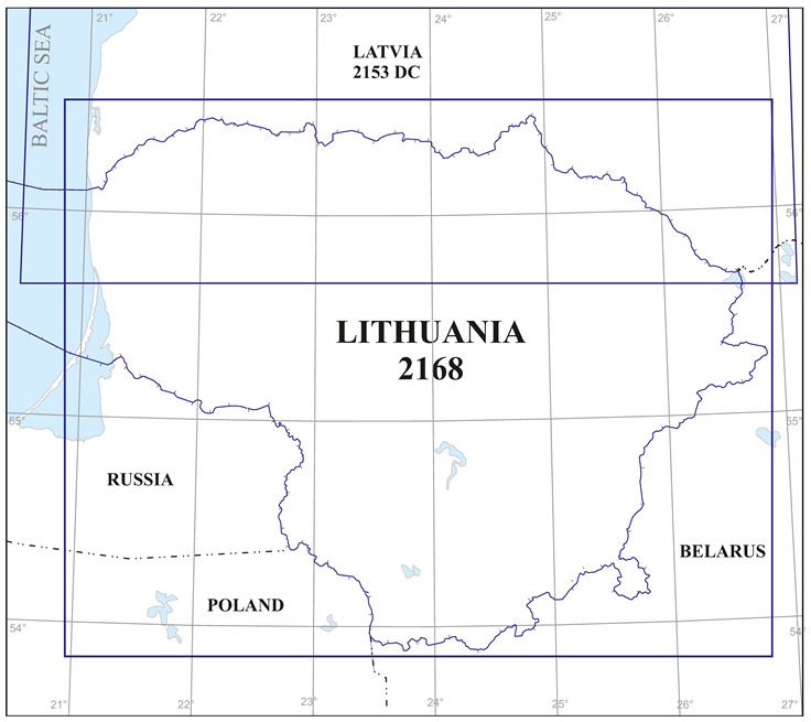
GEN 3.2.6 INDEX TO THE WORLD AERONAUTICAL CHART (WAC) – ICAO 1:500 000
GEN 3.2.7 TOPOGRAPHICAL CHARTS
To supplement the aeronautical charts, a wide range of topographical charts is available from:
| NATIONAL LAND SERVICE | |
| MINISTRY OF ENVIRONMENT | |
| Gedimino ave. 19 | |
| LT-01103 VILNIUS, LITHUANIA | |
| Tel.: | +370 706 86 666 |
| Email: | [email protected] |
| URL: | https://nzt.lrv.lt/ |
GEN 3.2.8 CORRECTIONS TO CHARTS NOT CONTAINED IN THE AIP
VFR Aeronautical Chart – ICAO 1:500 000 LITHUANIA is not contained in AIP Lithuania.
The publication of this issue invalidates the previous issue | |
|---|---|
| Vilnius FIR | |
| Vilnius FIR | |
| Vilnius FIR | |
| Vilnius FIR | |
| Vilnius FIR | |
| Vilnius FIR | |
| Vilnius AD | |
Consult NOTAM for latest changes.