| Flight information region (FIR) | |
| FIR sectors boundary | |
| ACC areas of responsibility (AOR) | |
| International boundaries | |
| Traffic information zone (TIZ), aerodrome traffic zone (ATZ) | |
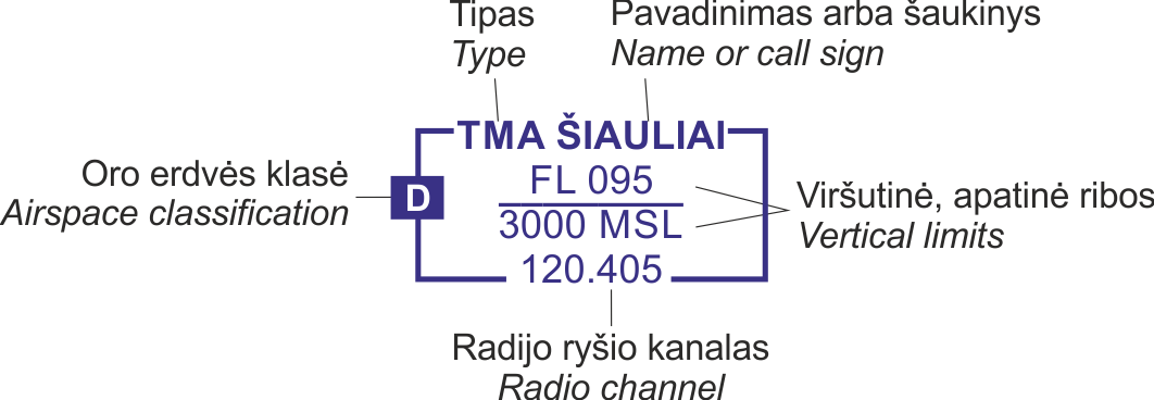
| Terminal control area (TMA) | |
| Sector or part within TMA | |
| Control tower zone (CTR) | |
| Recommended arrival routes for visual flight path compulsory with radio communication requirement | |
| Recommended departure routes for visual flight path compulsory with radio communication requirement | |
| Scale - break (on ATS route) | |
| On request reporting fly-by WPT | |
| Compulsory reporting fly-by WPT | |
| On request reporting flyover WPT | |
| Compulsory reporting flyover WPT | |
| Compulsory reporting point | |
| On request reporting point | |
| Profile of final approach fix or final approach point | |
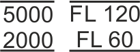
| Altitude/flight level "window” | |
| "At or above" altitude/flight level | |
| "At or below" altitude/flight level | |
| "Mandatory" altitude/flight level | |
| "Recommended" altitude/flight level | |
| Area minimum altitude (AMA) | |
| Prohibited (P), restricted (R), danger area (D), no planning zone (NPZ) | |
| Temporary segregated area (TSA), special gliders zone (SGZ) | |
| Common boundary of two areas | |
| Holding | VFR | IFR |
| |
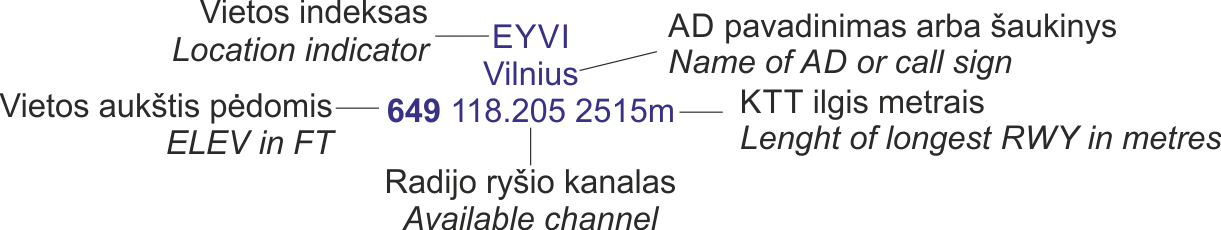
| Aeronautical data in abbreviated form | |
| Arrival/departure route | |
| Symbols of Free Route Airspace (FRA) |
| FRA boundary | |
| Compulsory entry/exit point | |
| On-request entry/exit point | |
| Arrival connecting point | |
| Departure connecting point | |
| Horizontal entry point | |
| Horizontal exit point | |
| Intermediate point | |